


BRACEVILLE TWP B Voting District, Trumbull County, Ohio
About
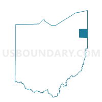
Outline

Summary
| Unique Area Identifier | 652576 |
| Name | BRACEVILLE TWP B Voting District |
| County | Trumbull County |
| State | Ohio |
| Area (square miles) | 8.08 |
| Land Area (square miles) | 8.07 |
| Water Area (square miles) | 0.01 |
| % of Land Area | 99.92 |
| % of Water Area | 0.08 |
| Latitude of the Internal Point | 41.22462130 |
| Longtitude of the Internal Point | -80.97175130 |
Maps


Graphs
Select a template below for downloading or customizing gragh for BRACEVILLE TWP B Voting District, Trumbull County, Ohio


Neighbors
Neighoring Voting District (by Name) Neighboring Voting District on the Map
- BRACEVILLE TWP A Voting District, Trumbull County, OH
- BRACEVILLE TWP C Voting District, Trumbull County, OH
- NEWTON FALLS CITY 2A Voting District, Trumbull County, OH
- NEWTON TWP B Voting District, Trumbull County, OH
- WINDHAM TWP A Voting District, Portage County, OH
- WINDHAM TWP B Voting District, Portage County, OH
- WINDHAM VILLAGE A Voting District, Portage County, OH
Top 10 Neighboring County Subdivision (by Population) Neighboring County Subdivision on the Map
- Newton township, Trumbull County, OH (8,875)
- Braceville township, Trumbull County, OH (2,856)
- Windham village, Portage County, OH (2,209)
- Windham township, Portage County, OH (1,865)
Top 10 Neighboring Place (by Population) Neighboring Place on the Map
Top 10 Neighboring Unified School District (by Population) Neighboring Unified School District on the Map
- LaBrae Local School District, OH (9,024)
- Newton Falls Exempted Village School District, OH (8,755)
- Windham Exempted Village School District, OH (4,079)
- School District Not Defined, OH (59)
Top 10 Neighboring State Legislative District Lower Chamber (by Population) Neighboring State Legislative District Lower Chamber on the Map
- State House District 68, OH (124,596)
- State House District 65, OH (102,284)
- State House District 64, OH (101,187)
Top 10 Neighboring State Legislative District Upper Chamber (by Population) Neighboring State Legislative District Upper Chamber on the Map
Top 10 Neighboring 111th Congressional District (by Population) Neighboring 111th Congressional District on the Map
Top 10 Neighboring Census Tract (by Population) Neighboring Census Tract on the Map
- Census Tract 9336, Trumbull County, OH (4,965)
- Census Tract 6006.03, Portage County, OH (4,074)
- Census Tract 9335, Trumbull County, OH (3,903)
- Census Tract 9337, Trumbull County, OH (2,863)